


Orrville High School, Dallas County, Alabama
About
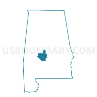
Outline

Summary
| Unique Area Identifier | 521648 |
| Name | Orrville High School |
| County | Dallas County |
| State | Alabama |
| Area (square miles) | 161.62 |
| Land Area (square miles) | 158.38 |
| Water Area (square miles) | 3.24 |
| % of Land Area | 97.99 |
| % of Water Area | 2.01 |
| Latitude of the Internal Point | 32.26700590 |
| Longtitude of the Internal Point | -87.21396080 |
Maps


Graphs
Select a template below for downloading or customizing gragh for Orrville High School, Dallas County, Alabama


Neighbors
Neighoring Voting District (by Name) Neighboring Voting District on the Map
- Beloit Community Center, Dallas County, AL
- Boykin, Wilcox County, AL
- Carlowville Minter VFD, Dallas County, AL
- Marion Jct Exp, Dallas County, AL
- New Friendship Church, Dallas County, AL
- Safford Community Center, Dallas County, AL
- Shiloh School, Voc Ag Bldg, Dallas County, AL
Top 10 Neighboring County Subdivision (by Population) Neighboring County Subdivision on the Map
- Orrville CCD, Dallas County, AL (2,804)
- Sardis CCD, Dallas County, AL (1,345)
- Alberta CCD, Wilcox County, AL (1,308)
- Carlowville CCD, Dallas County, AL (717)
- Safford CCD, Dallas County, AL (557)
Top 10 Neighboring Place (by Population) Neighboring Place on the Map
Top 10 Neighboring Unified School District (by Population) Neighboring Unified School District on the Map
Top 10 Neighboring State Legislative District Lower Chamber (by Population) Neighboring State Legislative District Lower Chamber on the Map
Top 10 Neighboring State Legislative District Upper Chamber (by Population) Neighboring State Legislative District Upper Chamber on the Map
Top 10 Neighboring 111th Congressional District (by Population) Neighboring 111th Congressional District on the Map
Top 10 Neighboring Census Tract (by Population) Neighboring Census Tract on the Map
- Census Tract 9569, Dallas County, AL (2,804)
- Census Tract 9571, Dallas County, AL (1,345)
- Census Tract 347, Wilcox County, AL (1,308)
- Census Tract 9570, Dallas County, AL (1,274)
Top 10 Neighboring 5-Digit ZIP Code Tabulation Area (by Population) Neighboring 5-Digit ZIP Code Tabulation Area on the Map
- 36767, AL (2,012)
- 36759, AL (1,501)
- 36761, AL (1,161)
- 36775, AL (800)
- 36720, AL (784)
- 36773, AL (512)